Home Screen Image

Bristol Maps


Utilize satellite imagery like never before to increase fishing efficiency.

Ugashik overlay screenshot

Latest Satellite Imagery


Navigate online or offline with downloadable satellite imagery

Zone Weather

NOAA Weather


Get the latest NOAA zone weather forecasts and save general weather to log entries

Tide screenshot

Tides


Get the latest NOAA tide charts with interactive graphs

Log entry screenshot

Logging Like Never Before


Log and analyze fishing data with seamless catch, weather and tide integration

Take Tour Take Tour

Stop guessing and start navigating. 
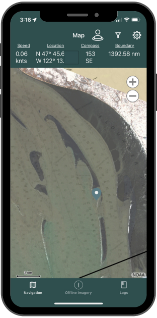
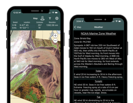
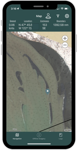
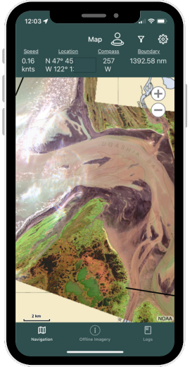
Bristol Maps is designed specifically for commercial fishermen to navigate using the latest satellite imagery. Say goodbye to outdated maps and inaccurate information - our app utilizes the latest, highly detailed images for increased efficiency, safer fishing trips, and a higher return on investment.

Available for

DOWNLOAD

Available for Android and iOS devices. Please select your device.


App

Log Analytics

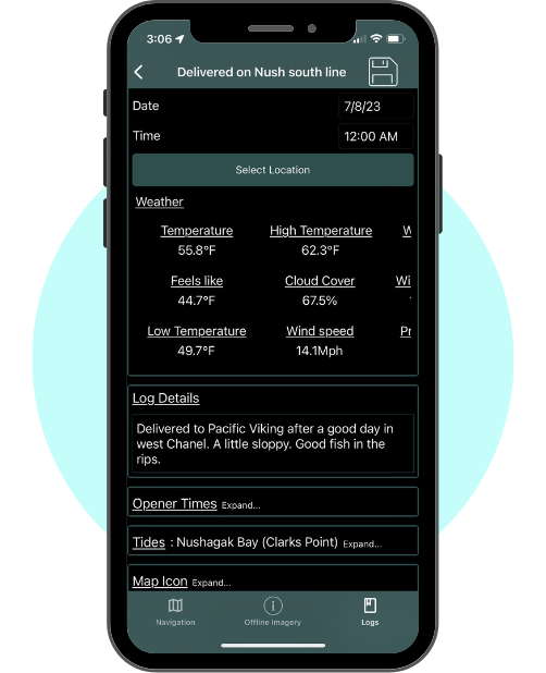
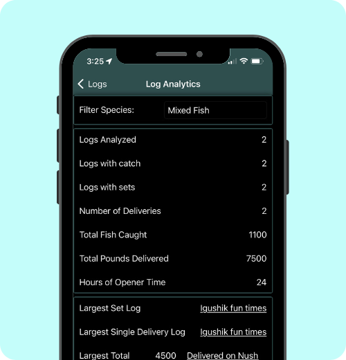
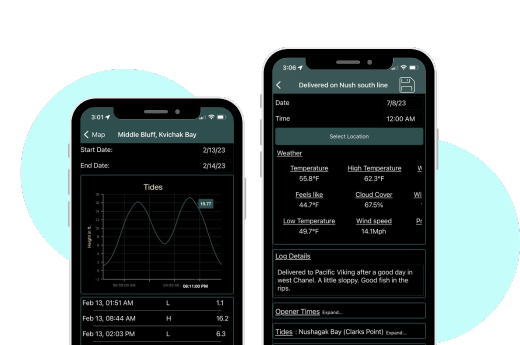
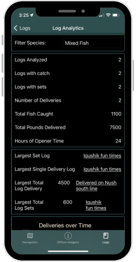
Take your fishing game to the next level with the power of your log history! By tracking your past fishing trips and analyzing the data, you can identify patterns and make informed decisions on where to head next. This will increase your chances of a successful catch and make your fishing experience more enjoyable. With log history, you'll have all the information you need right at your fingertips, making it easier to catch more fish and maximize your time on the water.

Features

Everything you need all and easily accessible.

  • Coming Spring 2024:
    • Updated Satellite images
    • Increased image resolution
    • Create private groups
    • Share location within groups
    • Share waypoints/routes within groups
    • Tide overlay on navigation page
  • Navigation Tools:
    • Latest satellite imagery
    • NOAA Charts
    • Overlay multiple maps and images
    • GPS tracking
    • Waypoint marking
    • Distance and heading calculations
    • Online or offline map access
  • Tide Forecasts:
    • Up-to-date tide information for all NOAA locations
    • Tide prediction graphs
    • Historical tide data for comparison
    • Offline access for favorite locations
  • Weather Forecasts:
    • NOAA Zone weather forecasts
    • Real-time weather updates
    • Hourly and daily forecasts
    • Wind speed and direction
    • Air and water temperature
    • Barometer readings
  • Log Books:
    • Customizable log entries
    • Record keeping for fishing trips and sets
    • Ability to add notes, photos, and weather/tide data
    • Access to previous logs for reference
    • Analysis over the course of a season or multiple years
  • Boundary Line Tools:
    • Pre-Populated with current ADF&G boundaries
    • Ability to pre-set fishing boundaries
    • Real-time boundary alarms when approaching pre-set boundaries
    • Ability to view and edit boundaries at any time
  • Share Data:
    • Send and receive Routes and Waypoints
    • Send and receive tracklines
    • Export log entries for deeper analysis

Pricing

Two week trial available!

  • Yearly Subscription
  • Continously updated satellite imagery
  • Detailed navigation
  • Weather updates
  • Tide tracking
  • Logging tools
  • $150/year