iOS & iPadOS
Download app for iOS today — $200/year.
Download for iOSStop guessing and start navigating.
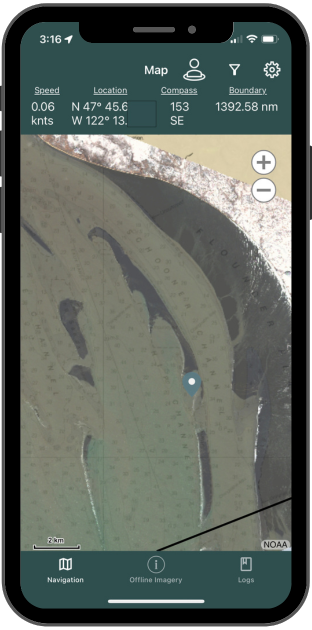
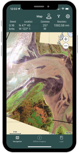
Bristol Maps is designed specifically for commercial fishermen to navigate using the latest satellite imagery. Say goodbye to outdated maps and inaccurate information - our app utilizes the latest, highly detailed images for increased efficiency, safer fishing seasons, and a higher return on investment.

Tools to provide a safer and more profitable season
Select for details
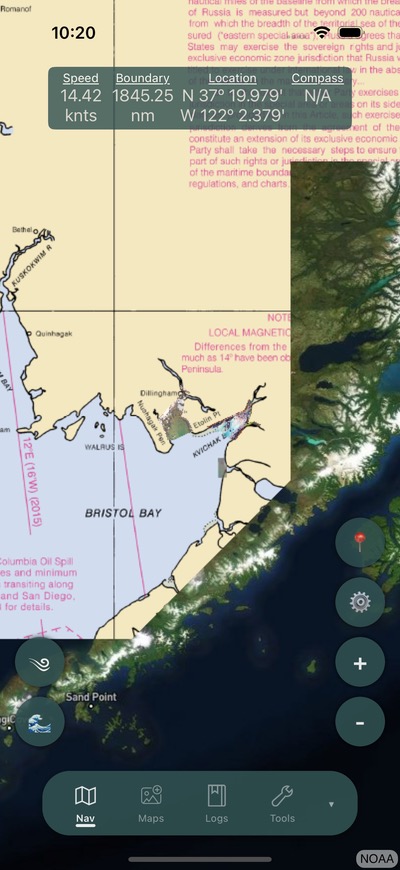

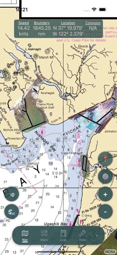
Stop relying on outdated charts. Bristol Maps delivers high-resolution satellite imagery of Alaska's fishing grounds, giving you the detail you need to navigate safely and efficiently.
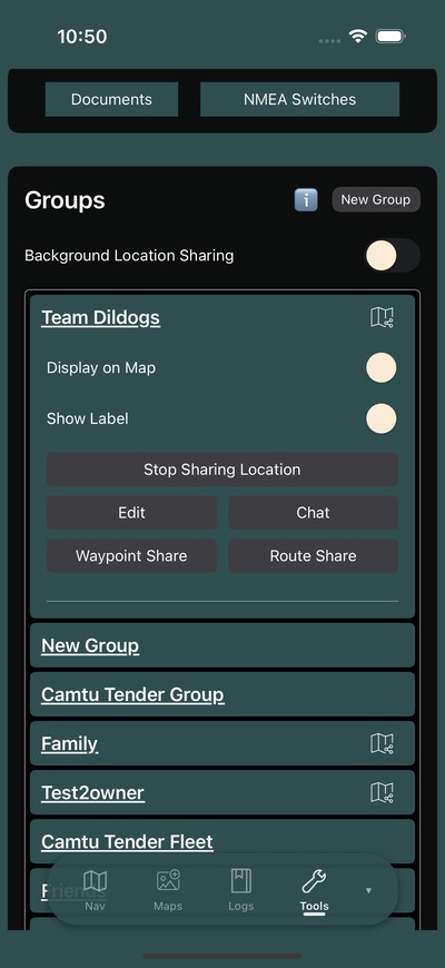
Keep your fleet connected on the water. Share real-time positions, communicate through fleet chat, and track vessels with AIS integration — all from one app.
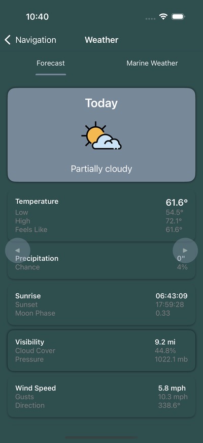
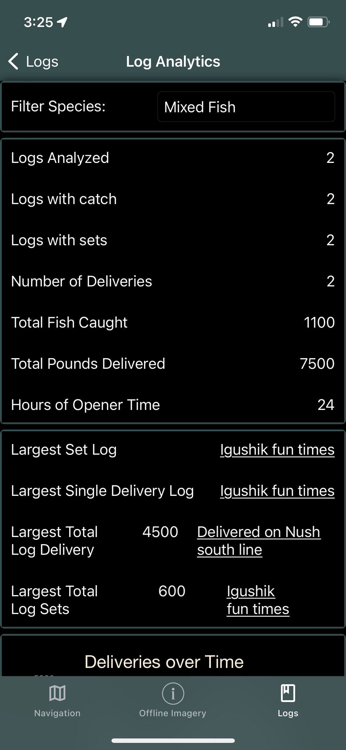
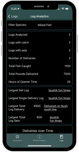
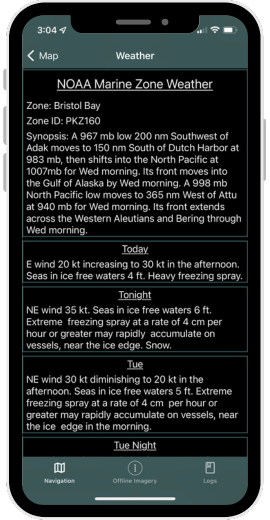
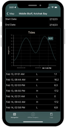
Turn your fishing data into actionable insights. Track your trips with digital log books, analyze season-over-season trends, and access NOAA tide and weather forecasts — all in one place.

Whether you're running a tender or managing a processing operation, Bristol Maps gives you the tools to track fish tickets, manage tenders, and coordinate freight — digitally.
Download for iOS and Android today — $200/year. Start your free trial
Navigation like no other.


One week free trial available
/year