Pot/Gear Tracking
Bristol Maps includes a gear tracking system for managing pot strings and gear positions on the map.
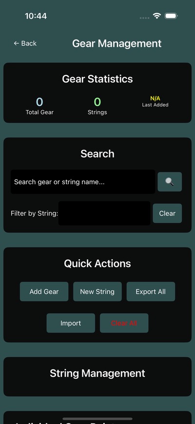
Gear Management Page
Access gear tracking from the navigation page via the gear button on the left sidebar. The gear management page shows:
- Total gear -- Total number of gear points tracked
- Strings -- Number of gear strings
- Gear per string -- Average gear count per string
Working with Strings
Gear is organized into strings -- groups of pots or gear deployed in a line.
Creating a String
- Open the gear management page
- Create a new string with a name
- Begin marking gear positions
Marking Gear Positions
As you deploy gear, mark each position on the map. Gear points are saved with their GPS coordinates and associated to the active string.
Auto First Pot
The auto first pot feature automatically marks the first pot position when you start a new string, using your current GPS position.
Display on Map
Gear points appear on the navigation page with:
- Custom colors per string
- String labels for identification
- Visual connection between gear in the same string
Toggle gear display from the navigation settings menu.
Track Lines for Strings
When deploying a string, track line recording can capture the path taken, creating a visual line connecting all gear positions in the string.
Related
- Track Lines -- Record paths while deploying gear
- Map Overview -- Gear display on the navigation page
- NMEA & GPS Setup -- GPS configuration for accurate gear positioning